Point list picking
Jump to navigation
Jump to search
Menu / Icon
This tool is accessible via the ![]() icon in the main upper toolbar or the 'Tools > Point list picking' menu.
icon in the main upper toolbar or the 'Tools > Point list picking' menu.
Description
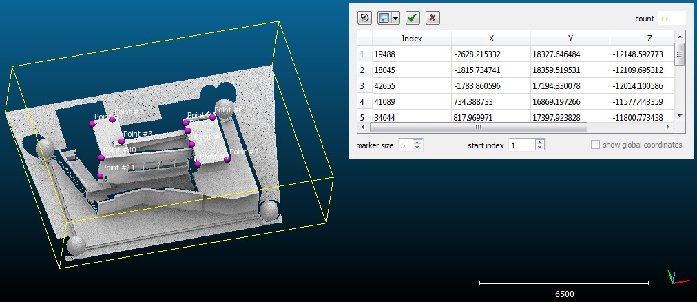
This tool lets the user pick several points on a cloud so as to create a 'list' of points.

'Point list picking' tool in action
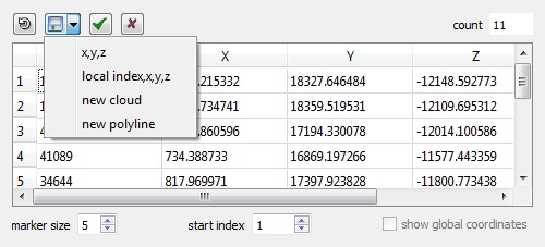
This list can then be exported as:
- a file
- a new cloud
- a polyline (picked points are simply connected)
It is very useful to create a 'Ground Control Points' (GCP) list for instance.
Procedure
One and only one point cloud should be selected in order to launch this tool.
A dedicated dialog will then appear in the top-right corner.
At any time the user can pick points on the selected cloud in the 3D view. These points will be automatically added to the list.
Here are the actions that can be undertaken while the dialog is visible:
- cancel the last picking action (

- export the list (see below)
- change the marker size in the 3D view (with the marker size spinbox)
- change the starting index (with the start index spinbox - default value: 0)
- validate the list (in which case all picked points will be 'saved' as a list of labels and the list will be restored when calling this tool again)
- cancel the picking process (the current list won't be saved - see above)
- if the cloud has been shifted, the global coordinates can be displayed/exported instead of the local ones
Note: see the equivalent PDF documentation for this tool.
Export options

The list can be exported as:
- an ASCII file with 'x,y,z' per line
- an ASCII file with 'index,x,y,z' per line (the 'index start' parameter is taken into account)
- a new cloud
- a polyline (not closed)